
The Extraordinary Climate Diversity of a Single Nation
There are very few countries in the world where a person can simultaneously experience a snowstorm in the north, a tropical downpour in the northeast, a scorching desert heatwave in the west, and pleasant coastal breezes in the south — all on the same day, within the borders of a single nation. India is one of those extraordinary exceptions. The sheer geographical span of the subcontinent, combined with the influence of two separate coastlines, the world’s highest mountain range, two great desert systems, and one of the most powerful seasonal wind systems on earth, produces a climate tapestry of remarkable complexity and variety.
Understanding weather across India is not simply a matter of knowing that it is hot in summer and cold in winter. The reality is far more nuanced. Different regions of India experience fundamentally different climate regimes — different temperature ranges, different rainfall patterns, different seasonal rhythms, and different extreme weather events. A farmer in Rajasthan and a tea grower in Assam live under climate conditions that are as different from each other as those of two separate continents.
This climate diversity is one of India’s defining geographical characteristics — and understanding it illuminates not just the weather but the agriculture, the culture, the architecture, the clothing, the food, and the entire way of life of the people who inhabit each of the country’s vastly different climate zones.
The Six Climate Zones That Define Weather Patterns Across India
Meteorologists and geographers typically divide India into six distinct climate zones, each characterized by a distinct combination of temperature range, rainfall pattern, seasonal variation, and humidity level. These zones are not rigid boundaries — they blend and transition at their edges — but they provide a useful framework for understanding why weather across India varies so dramatically.
The tropical wet climate zone covers much of the southwestern coast, including Kerala and coastal Karnataka, as well as the northeastern states. This zone is characterized by high temperatures throughout the year, abundant rainfall — particularly during the monsoon season — and high humidity. The distinction between seasons in this zone is primarily a distinction between the wet monsoon months and the somewhat drier post-monsoon period rather than between temperature extremes.
The tropical dry climate zone covers large parts of peninsular India, including interior Karnataka, Andhra Pradesh, and parts of Tamil Nadu. This zone experiences hot, dry summers, a distinct monsoon season, and cooler, dry winters. The temperature range is significant, and the availability of water — entirely dependent on the monsoon — shapes the agricultural calendar and the daily lives of the people who inhabit this zone.
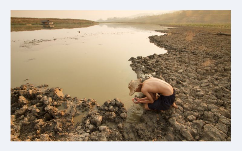
The semi-arid zone covers much of the Deccan Plateau and parts of Maharashtra, Telangana, and interior Andhra Pradesh. Rainfall here is lower and less reliable than in the tropical zones, making water management a constant challenge. Droughts are not uncommon, and the variability of the monsoon has profound implications for agricultural yields and rural livelihoods across this zone.
The arid zone covers Rajasthan and parts of Gujarat — the home of the Thar Desert, one of the most densely populated desert regions in the world. Weather in this zone is defined by extremes: searing summer temperatures that regularly exceed 45°C, bitterly cold winter nights, and annual rainfall that in some areas amounts to less than 100 millimeters. The survival strategies that human settlements have developed in this zone over centuries — from step wells to wind catchers to particular agricultural practices — are testaments to human adaptability under extreme climatic conditions.
The humid subtropical zone covers the vast Indo-Gangetic Plain — the agricultural heartland of India, encompassing Punjab, Haryana, Uttar Pradesh, Bihar, and West Bengal. This zone experiences hot, humid summers, a well-defined monsoon, and cool to cold winters. The temperature range between summer and winter is more pronounced here than in the peninsular zones, and the fertile alluvial soils of this region, watered by the great rivers and the monsoon, have supported some of the world’s largest and densest agricultural civilizations for millennia.
The mountain climate zone encompasses the Himalayan states — Himachal Pradesh, Uttarakhand, Sikkim, and the northeastern hill states. Temperature and rainfall patterns here vary dramatically with altitude, from the subtropical foothills to the arctic conditions of the high passes and glaciers. These mountain climates support extraordinary biodiversity and are the source of India’s great river systems — which in turn sustain the water security of hundreds of millions of people on the plains below.
The Indian Monsoon: The Weather Event That Defines a Nation
No discussion of weather across India can proceed far without a deep engagement with the Indian monsoon — arguably the single most important seasonal weather system on earth in terms of the number of human lives it directly affects. The southwest monsoon, which sweeps across the Indian subcontinent between June and September, delivers the rainfall that supports Indian agriculture, recharges the rivers and groundwater systems that supply drinking water to hundreds of millions, and shapes the rhythm of life, work, and culture across the entire nation.
The mechanics of the Indian monsoon are rooted in a differential heating pattern. As the Asian landmass heats up during the spring and early summer, it creates a vast low-pressure system that draws moisture-laden air from the Indian Ocean northward across the subcontinent. As this moist air rises over the land, it cools and releases its moisture as rainfall — the monsoon rains that transform the landscape from dry and dusty to lush and green within days of their arrival.
The monsoon does not arrive uniformly across India. It makes its first landfall on the Kerala coast in late May or early June and then progresses northward and eastward in a pattern that has been studied and documented for over a century. The western coast and the northeastern states receive the most intense rainfall. The interior of the peninsula and the Indo-Gangetic Plain receive less but still depend entirely on the monsoon for the majority of their annual rainfall. The northwestern arid zones receive the least, with the Thar Desert receiving only the tail end of the monsoon’s moisture.
The variability of the monsoon from year to year is one of the most consequential sources of uncertainty in the Indian economy and in the lives of Indian farmers. A strong monsoon year brings abundant rains, full reservoirs, good harvests, and rural prosperity. A weak or deficient monsoon year brings drought, crop failures, water shortages, and economic stress. The Indian government’s annual monsoon forecast is one of the most closely watched economic indicators in the country.
Summer Across India: From Extreme Heat to Pleasant Hill Retreats
Summer in India — broadly spanning March through June — is a season of enormous contrasts. In the plains of Rajasthan and the Deccan, it is a period of intense, sometimes dangerous heat. In the Himalayan foothills and hill stations, it is the most pleasant time of year — a period of clear skies, cool temperatures, and the scenic beauty that makes places like Shimla, Mussoorie, Ooty, and Coorg beloved destinations for summer retreats.
The heat of the Indian summer is not uniform. The northwestern plains — Rajasthan, parts of Punjab, and Haryana — experience some of the most extreme summer temperatures anywhere in the world. Hot, dry winds known locally as the loo blow across these plains during the peak summer months, carrying temperatures that can reach or exceed 48°C. Heat waves in this region are a genuine public health emergency, causing significant mortality and morbidity, particularly among vulnerable populations.
The coastal regions experience summer differently. The moderating influence of the sea keeps temperatures from reaching the extremes of the interior, but the combination of heat and high humidity creates its own form of discomfort. Coastal cities like Mumbai, Chennai, and Kolkata experience muggy, enervating summers where the apparent temperature — accounting for humidity — significantly exceeds the thermometer reading.
The northeast experiences a different summer still. Pre-monsoon thunderstorms — locally known in Assam and West Bengal as Kalbaishakhi or Nor’westers — bring dramatic evening storms that provide temporary relief from the heat and are associated with the ripening of the famous Alphonso mangoes in parts of Maharashtra and Gujarat.
Winter Across India: Snowfall in the North, Warmth in the South
The Indian winter, spanning roughly November through February, produces climate contrasts as dramatic as those of summer. In the Himalayan states, winter brings heavy snowfall that closes mountain passes, transforms landscapes into white wilderness, and creates the conditions that support India’s growing ski tourism industry in destinations like Gulmarg, Auli, and Solang Valley.
In the northwestern plains, winter brings cold waves that can push temperatures below freezing in cities like Amritsar and Delhi. Dense fog settles over the Indo-Gangetic Plain during the peak winter months — creating disruption to road and air travel but also providing a moisture input that benefits the winter wheat crop. The mustard fields of Punjab and Haryana, blanketed in yellow flowers against the winter fog, are one of the iconic images of the North Indian winter landscape.
Further south, winter is the most comfortable and pleasant season of the year. In peninsular India and along both coasts, winter temperatures are mild and agreeable, humidity is lower than during the monsoon months, and the skies are clear. This is peak tourist season for much of southern and central India — when the wildlife sanctuaries, heritage sites, and coastal destinations see their highest visitor numbers.
The northeast monsoon, which brings rainfall to the southeastern coast — particularly Tamil Nadu and coastal Andhra Pradesh — during the October to December period, distinguishes this region from the rest of India. When the rest of the country is experiencing its dry post-monsoon season, the Coromandel Coast is receiving its primary annual rainfall. This counter-intuitive seasonal pattern has shaped the agricultural calendar, the architecture, and the culture of the region in distinctive ways.
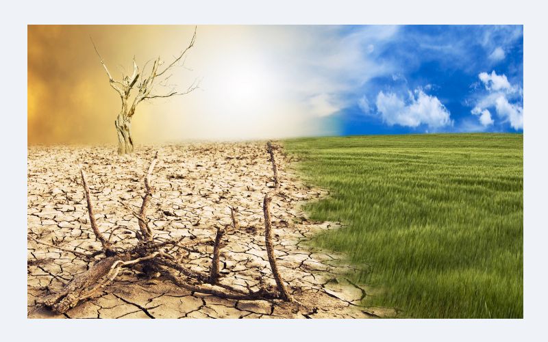
How Climate Change Is Reshaping Weather Patterns Across India
The weather patterns that Indian civilization has adapted to over millennia are being altered by climate change in ways that are already measurable and are projected to intensify. Rising average temperatures, changes in monsoon timing and intensity, more frequent and severe extreme weather events, and shifting seasonal boundaries are all documented trends that will have profound implications for agriculture, water security, public health, and economic stability across the subcontinent.
Heat waves across India are becoming more frequent, more intense, and longer in duration. Cities that historically experienced a few days of extreme heat each summer are now enduring extended heat wave periods. The public health burden of this trend falls disproportionately on outdoor workers, elderly people, and those in low-income households without access to cooling — creating a climate justice dimension to a challenge that is already significant in purely meteorological terms.
Monsoon variability — already a major source of agricultural risk — is increasing under climate change projections. Some regions are projected to receive more intense rainfall over shorter periods, increasing the risk of flooding and waterlogging. Other regions may experience longer dry spells between rain events, increasing drought stress for crops. The total monsoon rainfall may not change dramatically in some projections, but its distribution in time and space — and the reliability of its arrival — are projected to become more variable and therefore more difficult to plan around.
India’s weather is not a single story but a vast, layered, endlessly fascinating collection of regional stories — each shaped by geography, geography, and the extraordinary forces that act upon a subcontinent sitting at the intersection of the world’s most powerful seasonal wind system and the world’s highest mountain range. Understanding this diversity is understanding something fundamental about India itself — a country where the weather is not a backdrop to life but one of its most powerful and persistent characters.


